
Tuscaloosa County ZIP Coverage
A ZIP is a United States Postal Service delivery tool. It is not a municipal boundary, voting district, parcel line, or promise that an address lies within Tuscaloosa County. The inventory includes core Tuscaloosa and Northport routes plus rural and county-edge ZIPs useful for research routing. Some edge routes serve land in more than one county. The USPS ZIP Code Lookup must settle the current mailing result for a complete address.
| ZIP | Areas represented | Postal identity | Research caution |
|---|---|---|---|
| 35401 | Central/west Tuscaloosa, Downtown, West End, UA-adjacent | Tuscaloosa delivery | Crosses neighborhood and service lines |
| 35402 | Tuscaloosa PO boxes | Tuscaloosa PO-box ZIP | Not residential geography |
| 35403 | Government and organizational PO mail | Tuscaloosa unique/PO use | City uses P.O. Box 2089 here |
| 35404 | East Tuscaloosa, Alberta, Holt-Cottondale edge | Tuscaloosa delivery | City and unincorporated transitions |
| 35405 | South Tuscaloosa, Skyland, Taylorville edge | Tuscaloosa delivery | Extends beyond core city neighborhoods |
| 35406 | North/northeast Tuscaloosa, Lake Tuscaloosa approaches | Tuscaloosa delivery | Suburban and unincorporated interface |
| 35407 | University of Alabama mail | Institution ZIP | Not a neighborhood resident roll |
| 35440 | Abernant | Abernant/Bessemer routing | Verify county edge |
| 35441 | Akron vicinity | Akron | Rural and county-line routes |
| 35442 | Aliceville area edge | Aliceville | Parts may lie outside the county |
| 35444 | Brookwood | Brookwood | Municipal and rural routes |
| 35446 | Buhl and Echola rural west | Buhl | Unincorporated area |
| 35447 | Carrollton edge | Carrollton | Verify county-border routing |
| 35449 | Coaling | Coaling | Municipality and rural delivery |
| 35452 | Coker | Coker | Town and rural routes |
| 35453 | Cottondale and Duncanville | Cottondale | City fringe and unincorporated pockets |
| 35456 | Duncanville | Duncanville | Southeastern rural county |
| 35457 | Echola and Elrod | Echola | Western rural delivery |
| 35458 | Elrod | Elrod | Rural route |
| 35459 | Emelle edge | Emelle | Verify county line |
| 35460 | Epes edge | Epes | Verify county line |
| 35462 | Eutaw edge | Eutaw | Mostly Greene County; verify parcel |
| 35463 | Fosters | Fosters | Southwest unincorporated area |
| 35464 | Gainesville edge | Gainesville | Rural county-border route |
| 35466 | Gordo edge | Gordo | West county-edge routes |
| 35468 | Kellerman | Kellerman | Rural area with company-town history |
| 35469 | Knoxville edge | Knoxville | County-border routes |
| 35470 | Moundville | Moundville | Tuscaloosa and Hale County context |
| 35473 | Northport | Northport | City and northern fringe |
| 35474 | Moundville and UA-related mail uses | Moundville | Verify exact address |
| 35475 | Northport and Samantha | Northport | Large suburban and rural area |
| 35476 | Northport | Northport | Older/core Northport delivery |
| 35477 | Panola edge | Panola | Verify county line |
| 35478 | Peterson | Peterson | Eastern rural county |
| 35480 | Ralph | Ralph | Southwest rural county |
| 35481 | Reform edge | Reform | Western county edge |
| 35482 | University of Alabama PO and unique uses | Tuscaloosa | Institutional, not residential geography |
| 35486 | University and organizational mail | Tuscaloosa | Unique use; verify recipient |
| 35487 | University of Alabama | Tuscaloosa | Unique institution ZIP |
| 35490 | Vance | Vance | Tuscaloosa/Bibb line |
| 35546 | Berry | Berry | Northern Tuscaloosa/Fayette routes |
This Tuscaloosa County ZIP code directory intentionally retains edge entries instead of presenting a false city-only list. USPS does not publish an official narrative tying each neighborhood to a ZIP. The area labels above are research aids, while an exact address needs live USPS confirmation and a county parcel check.
Tuscaloosa ZIP Patterns Differ
The 35401 through 35406 group contains the best-known Tuscaloosa identities, yet even this compact number range mixes delivery, post-office box, and government mail uses. A list grouped by number can hide that distinction. A person connected to 35402 may have supplied a box, while a 35404 or 35406 street can sit near an unincorporated transition.
Northport adds another pattern. ZIPs 35473, 35475, and 35476 cover core city, suburban, and broad rural settings. The postal word “Northport” cannot settle the parcel’s municipality. Rural routes near Abernant, Aliceville, Eutaw, Moundville, Vance, or Berry require even more care because postal service and county jurisdiction can cross.
Tuscaloosa University ZIP Quirk
The University of Alabama creates a local ZIP code trap. ZIPs 35407 and 35487, plus related 35482 and 35486 routing, serve institutional or organizational mail. They are not four residential neighborhoods. A university address may point to a campus unit, student-oriented complex, or mail operation rather than a long-term household.
University turnover also makes date matching vital. Preserve the date and role of each source, and never treat a campus directory affiliation as proof of a home address.
Find Tuscaloosa Residents by ZIP
A ZIP code directory narrows geography, but no official tool documented in the research offers a free list of every resident in one ZIP. USPS verifies a single address. The county assessor connects owners and parcels, while its annual valuation PDFs are grouped by owner letters or parcel numbers, not by ZIP. My Voter Page checks one person with identifying inputs and cannot enumerate a postal area.
- Standardize the complete street address with USPS and save the current city, state, and ZIP result.
- Open the Tuscaloosa County Mapping Department route and identify the parcel and municipal context.
- Compare situs, which is the taxable physical location, with the owner mailing address. Do not merge them.
- If a live property portal offers a ZIP filter, verify its fields and limits before relying on it. That function was not confirmed in the accessible research.
- Once the search reaches a named road, use the Tuscaloosa County streets lookup for parcel-by-parcel work.
A lawfully purchased statewide voter file may have residence fields that can be sorted under its terms, but the individual My Voter Page form is not that file. It asks for first name, last name, and date of birth to verify a registration and polling information. Ballot choices remain secret.
Tuscaloosa ZIP Search Fields
The captured USPS form is the reliable first check for postal standardization. Enter the full address as it is known. The returned postal city still does not prove municipal jurisdiction, but it supplies the current delivery form needed before a parcel search or a narrow city records request.
| USPS control | Input type | Required | Use in Tuscaloosa County |
|---|---|---|---|
| Street Address | Text | Yes | Enter the complete delivery address |
| City | Text | Yes | Postal city is not proof of municipality |
| State | Dropdown | Yes | Select Alabama |
View the USPS ZIP lookup source used for the manifest capture.
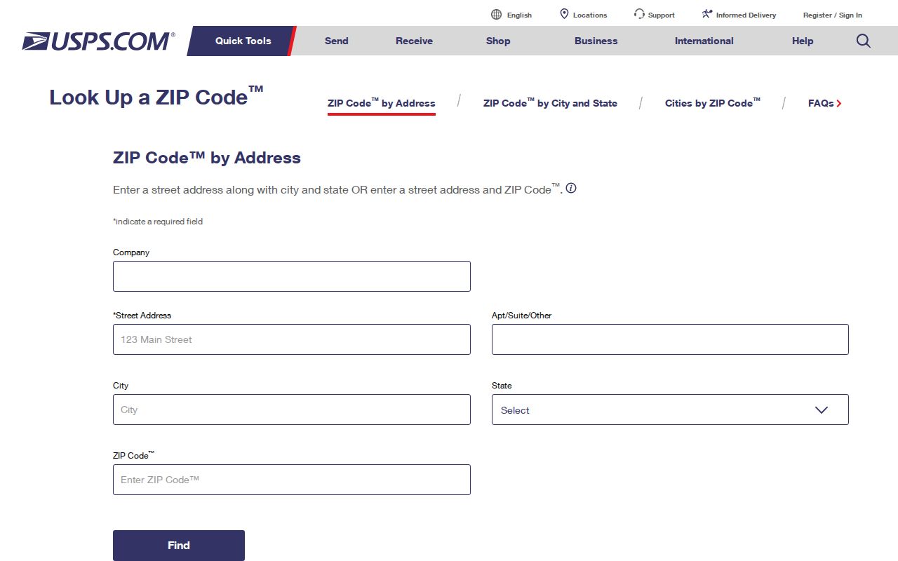
The image shows the address-first search surface that should precede any Tuscaloosa County parcel or jurisdiction conclusion.
Tuscaloosa ZIP and City Limits
Tuscaloosa delivery labels cross city and unincorporated lines. Northport labels do the same. Postal routing, municipal services, and county record custody answer different questions. Use USPS for the mail form, county GIS for the parcel and boundary context, and the relevant municipal office for city-created permits or reports.
- ZIP Code
- A five-digit USPS delivery area or mail-routing identity, not a civil boundary.
- ZIP+4
- A more precise postal segment added to a five-digit ZIP for a delivery point or small group.
- PO-box ZIP
- A code used for post-office boxes rather than a mapped residential area.
- Unique ZIP
- A code assigned to a large institution or high-volume recipient.
- Carrier route
- A delivery sequence used by postal carriers; it is not a parcel or neighborhood boundary.
For an address tied to Tuscaloosa city records, the City Clerk public-record request can route administrative or fire material not already online. The form needs contact details and a record description specific enough to locate the item.
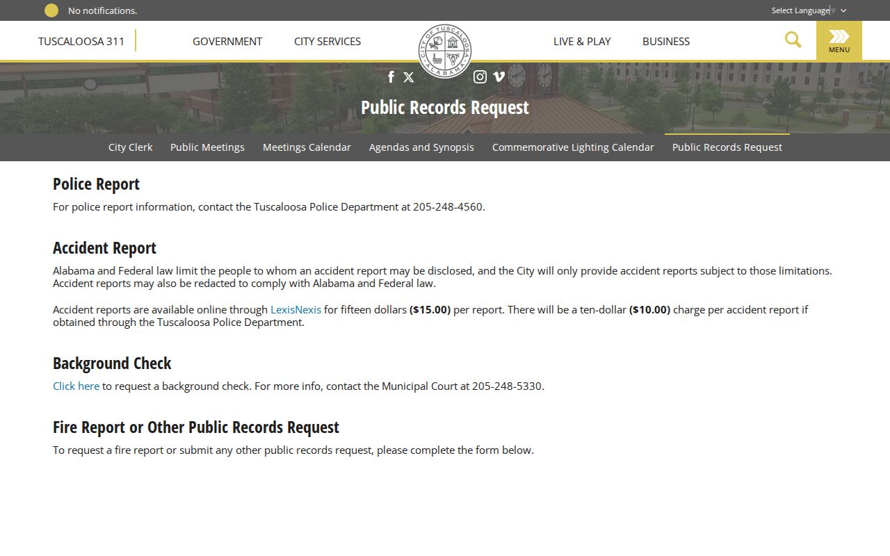
The captured city request page illustrates why jurisdiction must be checked before sending an address-based request to a custodian.
Tuscaloosa ZIP Address Layers
Three address forms often appear in property work. The situs address locates the taxable property. The mailing address tells where the owner’s tax or contact mail goes. The legal description ties title to land through subdivision, lot, block, section, or other recorded terms. A ZIP update most often changes the mailing layer, while the parcel and legal description preserve continuity.
An owner mailing address outside Tuscaloosa County does not identify who occupies the local parcel. Likewise, a homestead or tax-class flag can support an ownership fact for a stated tax year but cannot name every person at the property. Keep the year, field label, and source with every extracted value.
Note: County ownership maps derive from deeds, plats, wills, assessments, and surveys, but the county says they are not conveyance documents.
Tuscaloosa ZIP Statistics Need Labels
Census ZIP Code Tabulation Areas, called ZCTAs, approximate ZIP geography for statistics. They are not USPS delivery boundaries. Label a ZCTA table or map as a statistical approximation and avoid assigning an exact home to it without address-level confirmation.
Tuscaloosa County’s scale explains why the mismatch matters. The 2025 population estimate is 241,368 across 1,320.85 square miles. Dense Tuscaloosa blocks, Northport suburbs, small municipalities, river and lake areas, and long rural routes all sit within the same county record jurisdiction. One countywide rate cannot describe each postal zone.
Verify Tuscaloosa County ZIP Records
If a postal result and parcel map appear to conflict, keep both and ask the office responsible for each field. USPS resolves delivery format. Tuscaloosa County Mapping or 911 should confirm county address assignment, while municipal planning handles city-specific jurisdiction questions. The research did not locate an official countywide renumbering history or address-assignment application, so no date or procedure should be inferred.
The assessor’s current valuation lists offer a fallback when an interactive search fails. They are arranged by owner and parcel rather than ZIP. A city records request can search a known address and date range, but a permit applicant, contractor, or contact person is project evidence, not proof of current occupancy. The sound ZIP code directory result ends with a verified postal address, a matched parcel, and a clearly named custodian.